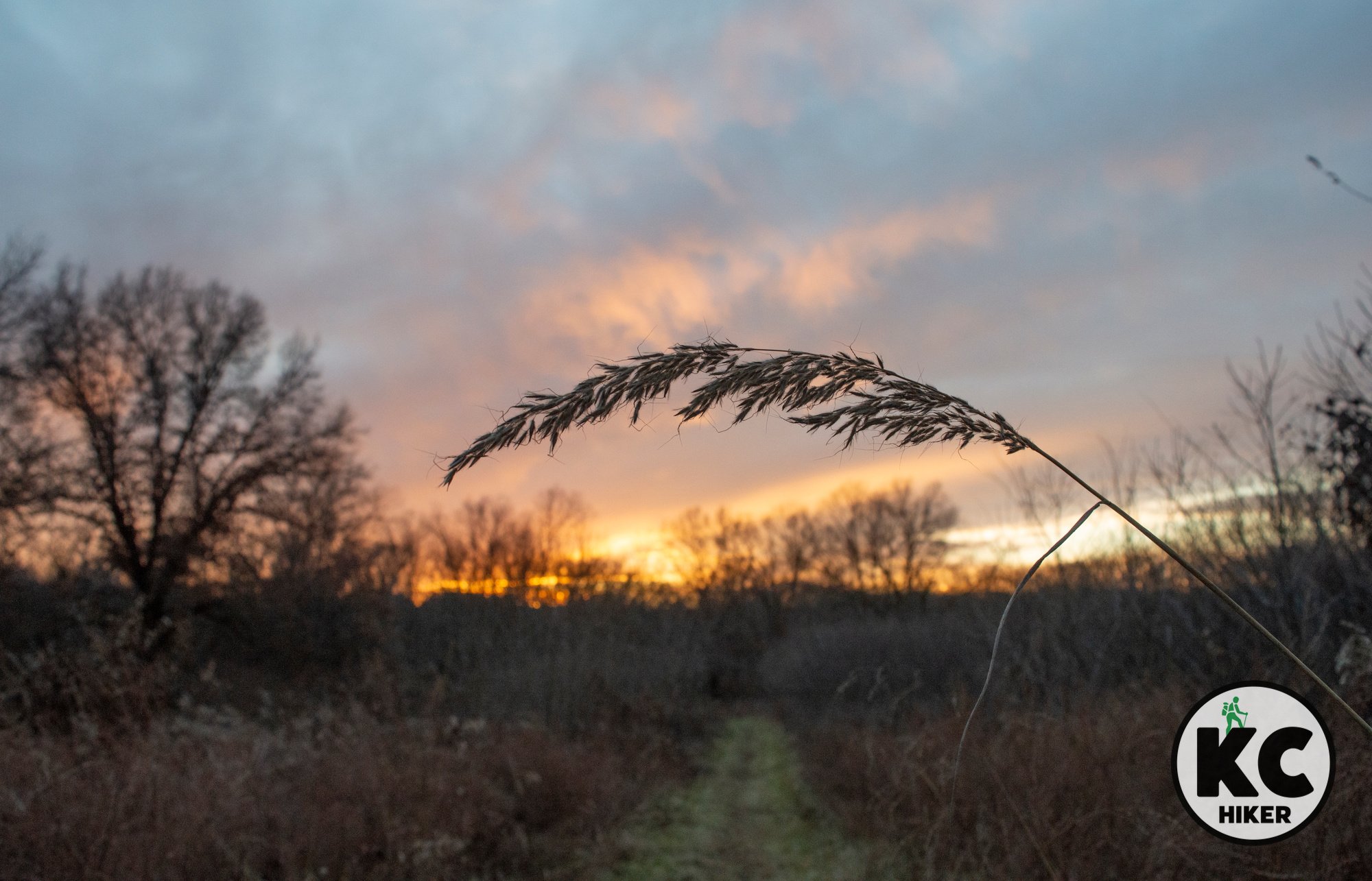
Grand Bluffs rise 300-feet above mid-Missouri
Central Missouri’s river country is a scenic part of the state that few people experience. Grand Bluffs Conservation Area, near Hermann, is one of these remote gems. The KATY Trail runs at the bottom of the bluffs next to Highway 94. Looking up, towering dolomite bluffs form a natural skyline above the fertile valley. For hikers, a steep 2.1-mile out-and-back trail leads to the top of the ridge through upland timber. When leaves are off, the river, valley and distant bluffs can be seen through the trees and at one lookout platform (look for the exit on the south side of the trail). When foliage is in full bloom, it’s still an excellent walk, but visibility is limited. A trailhead parking lot is available off Bluffton Road, as is a primitive camping area.

Hikers walk above striking limestone cliffs towering over the Missouri River Valley.
Trail Out-and-back trail at Grand Bluffs Conservation Area, Rhineland, Mo.
Overview
Central Missouri’s river country is a scenic part of the state that few people experience. Grand Bluffs Conservation Area, near Hermann, is one of these remote gems. The KATY Trail runs at the bottom of the bluffs next to Highway 94. Looking up, towering dolomite bluffs form a natural skyline above the fertile valley. For hikers, a steep 2.1-mile out-and-back trail leads to the top of the ridge through upland timber. When leaves are off, the river, valley and distant bluffs can be seen through the trees and at one lookout platform (look for the exit on the south side of the trail). When foliage is in full bloom, it’s still an excellent walk, but visibility is limited. A trailhead parking lot is available off Bluffton Road, as is a primitive camping area.
Length A 2.1-mile out-and-back trail leads to the top of the bluffs.
Address and location
Grand Bluffs Conservation Area, Rhineland, MO 65069. See the map below for specific directions to the trailhead.Distance Grand Bluffs Conservation Area is about two hours and 45 minutes from Downtown Kansas City.
Conditions This is a natural surface trail with steep elevation changes. The trail is well-marked and easy to follow.
Kid friendly? Children will need to be able to walk this natural surface trail, including steep inclines.
How busy? This is a remote and quiet conservation area, although it may experience more visitors during deer and turkey hunting seasons.
Pets Yes
Bikes Yes


Nature-by-appointment awaits at Prairie Garden Trust
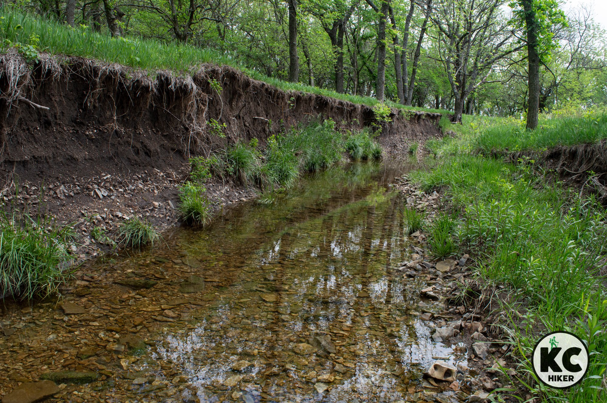
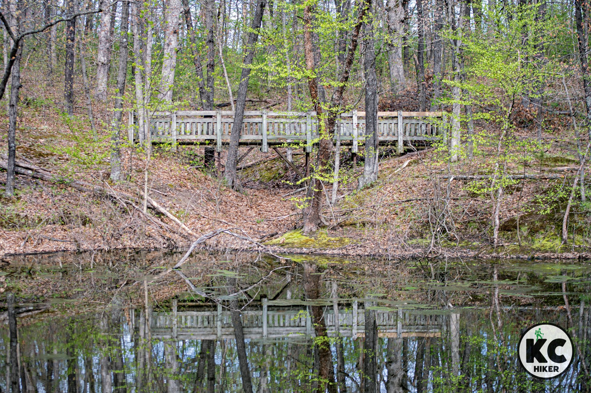
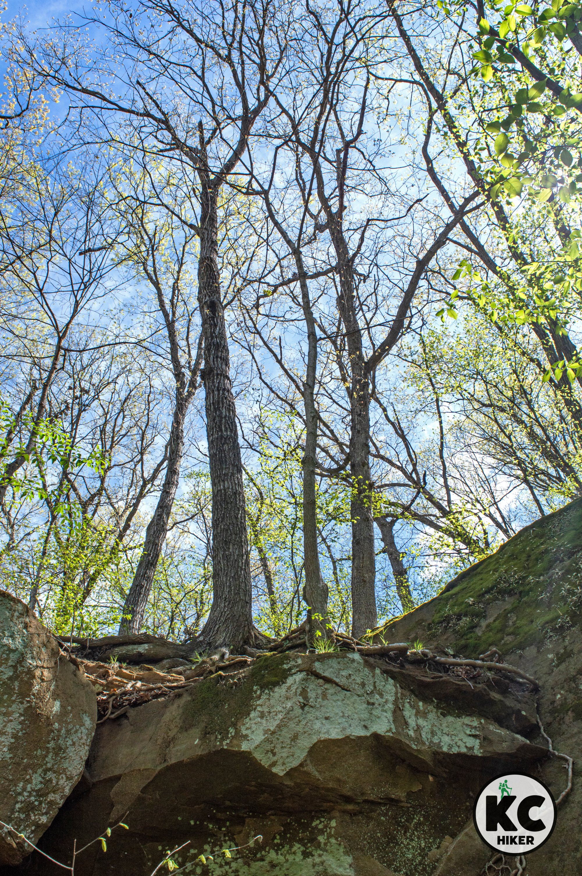
Prairie Garden Trust preserves a naturally diverse area about 20 minutes north of Jefferson City, Mo. This 240-acre park is privately owned and can be visited by appointment-only from April 1-Oct. 31. It offers more than 10 miles of natural surface trails beside ponds, through prairie and forest and below a rocky bluff rising above Hillers Creek.

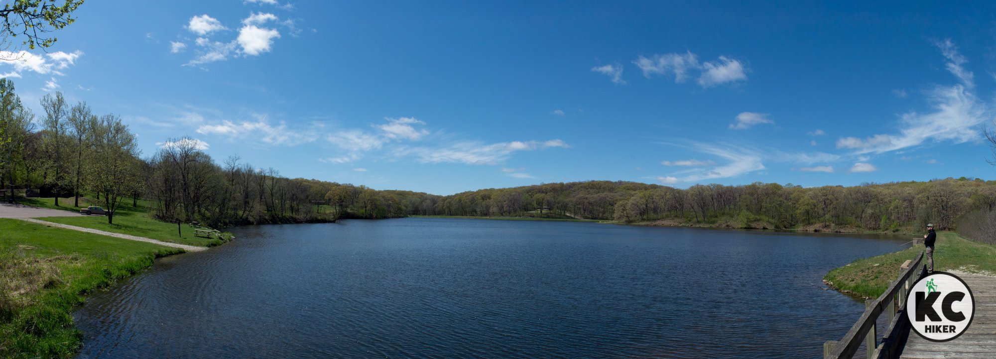
Prairie Garden Trust, near New Bloomfield, Mo.
This stunning private reserve is open to visitors who make a reservation from April 1-Oct. 31.
Trail Trails at Prairie Garden Trust, New Bloomfield, Mo.
Overview
Prairie Garden Trust preserves a naturally diverse area about 20 minutes north of Jefferson City, Mo. This 240-acre park is privately owned and can be visited by appointment-only from April 1-Oct. 31. It offers more than 10 miles of natural surface trails beside ponds, through prairie and forest and below a rocky bluff rising above Hillers Creek. In addition to the natural elements, there are some planted and manicured areas that show off nature’s native beauty. Two short, paved trails provide access for wheelchairs and strollers to Beaver Lake and the Lotus Ponds.
Length There are about 10 miles of trails throughout the park.
Address and location
Prairie Garden Trust, 8945 Co. Rte. 431, New Bloomfield, MO 65063. Travel on gravel roads is required for a few miles.Distance The trailhead is about two hours and 30 minutes from Downtown Kansas City.
Conditions This is a natural surface trail with moderate elevation changes. There are two short, paved paths that provide disability access. Restrooms are available at the parking area.
Kid friendly? Children will need to be able to walk this natural surface trail (with the exception of the short, paved trails mentioned above).
How busy? This is a private property providing access by reservation only.
Pets No
Bikes No
Trails near Prairie Garden Trust


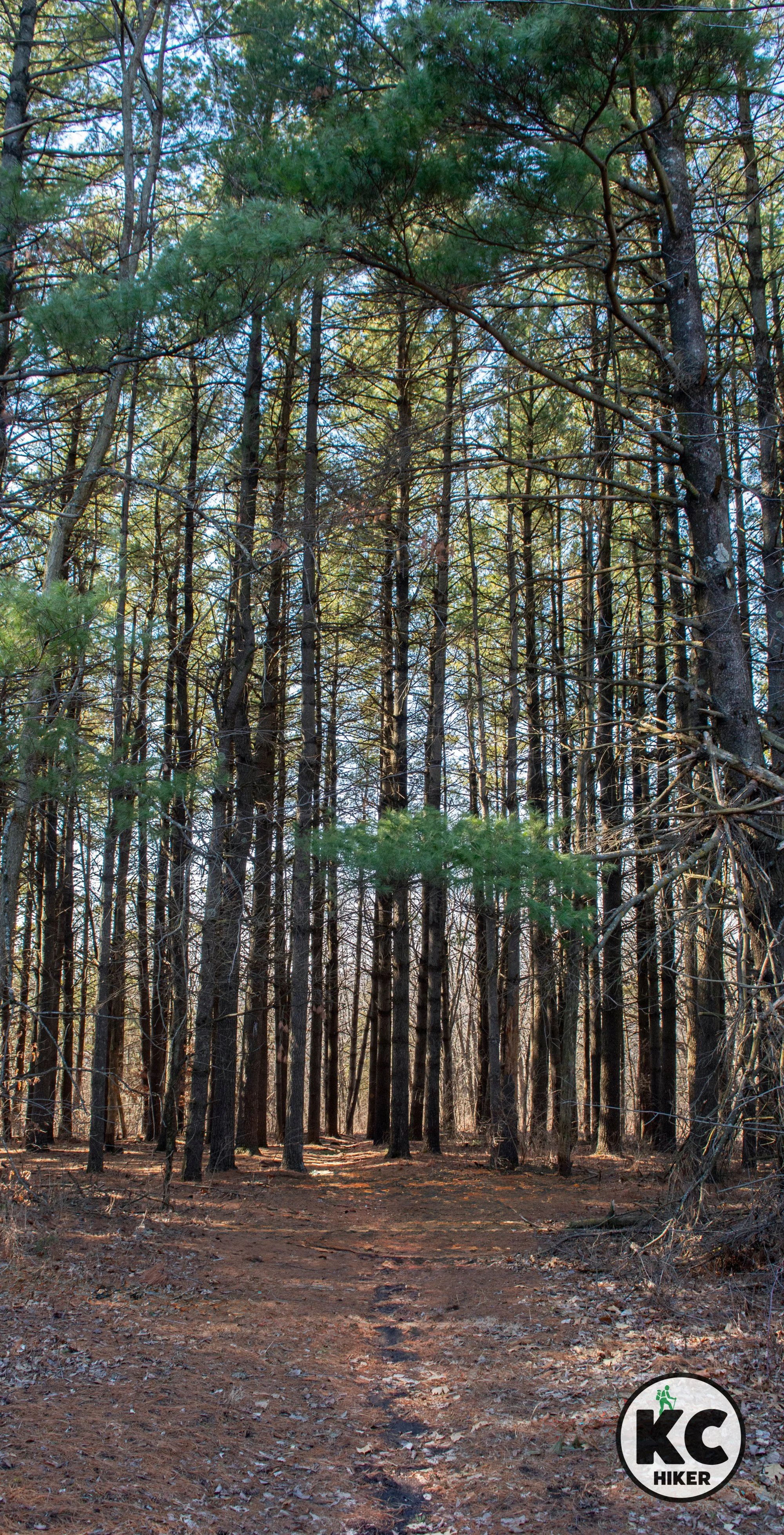
Woodlands interrupt the Iowa prairie at Stephens State Forest
The rolling farmlands of northern Missouri and southern Iowa were once a mix of prairie and forest before European settlement, with some woodlands still preserved today. Stephens State Forest in southern Iowa, covering over 15,000 acres across five counties, features trees planted by the Civilian Conservation Corps in the 1930s, including impressive groves of Douglas Fir reaching over 70 feet in height. Divided into districts like Lucas, Whitebreast, and Woodburn, the forest offers over 30 miles of multi-use trails and five backcountry campsites in the Woodburn Unit. This tranquil area provides an ideal setting for observing wildflowers and wildlife.

The Whitebreast Unit of Stephens State Forest, Iowa.
More than 15,000 acres offer more than 30 miles of hiking trails and backcountry campsites.
Trail More than 30 miles of multi-use trails can be found in Stephens State Forest in southern Iowa.
Overview
The rolling farmlands of northern Missouri and southern Iowa were not always so. Before European settlers arrived, this vast region was a combination of prairie and forest. Some of these woodlands remain. At Stephens State Forest in southern Iowa, more than 15,000 acres are preserved across five counties. These trees were planted by the Civilian Conservation Corps in the 1930s. The forest includes striking groves of Douglas Fir trees, which can reach more than 70 feet in height.
Stephens State Forest is divided into districts. The Lucas, Whitebreast, and Woodburn units are located southwest of Lucas, Iowa. Between them, these areas are home to more than 30 miles of multi-use trails. Five backcountry campsites in the Woodburn Unit are available on a first-come, first-serve basis. This quiet region is an excellent place to observe wildflowers and wildlife.
Length There are more than 30 miles of multi-use trails across the forest’s Lucas, Woodburn and Whitebreast units.
Address and location There are seven different units of Stephens State Forest. The address to the Lucas Unit is 48546 137th Trail, Lucas, IA 50151. View the trail and locator maps below for specific addresses and trailhead locations.
Conditions
Trails are natural surface and well marked. Equestrian traffic has put extra wear on some sections of trail. In addition, these routes will be slippery after rain or snow melt, so wear sturdy boots and bring trekking polls.Kid friendly? This trail is for hearty children only.
How busy? This area is rural and remote. However, it is about one hour from the Des Moines area and can have moderate traffic in peak season.
Pets Yes, on a leash.
Bikes Yes, unless posted otherwise.

The Whitebreast Unit of Stephens State Forest, Iowa.

The Whitebreast Unit of Stephens State Forest, Iowa.

The Whitebreast Unit of Stephens State Forest, Iowa.
The Whitebreast Unit of Stephens State Forest, Iowa.
Stephens State Forest, Lucas Unit
Stephens State Forest, Whitebreast Unit
Stephens State Forest, Woodburn Unit

Where eagles soar: The Smokehouse Trail at Clinton Lake
The Smokehouse Trail is named for a stone structure built in 1892, which also functions as the trailhead for this 2-mile loop. The trail explores the bottomland forest environment of the western shore of the 7,000-acre Clinton Lake. While Clinton Lake State Park provides trails on the lake’s eastern side (adjacent to Douglas), this trail is managed by the Corps of Engineers. The Smokehouse Trail is an easy walk through a meadow, riparian woods and across a few creeks. It then follows the lakeshore before completing the loop. The lakeshore is an excellent area for wildlife viewing, including eagles, migratory birds and birds and waterfowl. Interesting geological features include the presence of granite rocks in the lower elevations. In addition to the trail, there is a boat ramp at the Bloomington Public Use Area (of which the trail is a part) that provides extensive lake access and an opportunity to view waterfowl.

This hike provides a potpourri of local history, wildlife and geology beside the lake.
Trails The Smokehouse Trail at Clinton Lake
Overview
The Smokehouse Trail is named for a stone structure built in 1892, which also functions as the trailhead for this 2-mile loop. The trail explores the bottomland forest environment of the western shore of the 7,000-acre Clinton Lake. While Clinton Lake State Park provides trails on the lake’s eastern side (adjacent to Douglas), this trail is managed by the Corps of Engineers. The Smokehouse Trail is an easy walk through a meadow, riparian woods and across a few creeks. It then follows the lakeshore before completing the loop. The lakeshore is an excellent area for wildlife viewing, including eagles, migratory birds and birds and waterfowl. Interesting geological features include the presence of granite rocks in the lower elevations. In addition to the trail, there is a boat ramp at the Bloomington Public Use Area (of which the trail is a part) that provides extensive lake access and an opportunity to view waterfowl.
Length 2 miles.
Address and location
The Smokehouse Trail is part of the U.S. Corps of Engineers Bloomington Public Use Area on the western shore of Clinton Lake near the tiny town of Clinton. The address is County Road 6, Lawrence, KS 66047. The map below will lead you directly to the trailhead. If the gate is closed, simply park off-road and walk 100 yards toward the Smokehouse. You will see the trailhead sign.Distance The trailhead is about one hour from Downtown Kansas City.
Conditions This is a natural surface trail with moderate elevation changes. It’s well-maintained and expertly marked with hiker icons. You’ll encounter rocks and roots. It will be muddy after a rain or snow melt. It’s best hiked from fall to spring, as summer will bring spiderwebs, ticks and some overgrowth.
Kid friendly? Children will need to be able to walk the trail. An “industrial strength” stroller might be doable.
How busy? You’ll probably have it to yourself in the off-season. When the campground is open, there is more traffic.
Bikes Yes.
Pets Yes, on a leash.

The historic smokehouse was built in 1892. The trailhead is immediately to its south.

This eagle was photographed flying over Clinton Lake along the trail.


Hiking, history and architecture connect at Bothwell Lodge Historic site
Bothwell Lodge is a state historic site near Sedalia, Mo., that is home to a 12,000-square-foot mansion as well as 3.7 miles of hiking trails through rolling, wooded terrain.

A wealthy attorney left a legacy of architecture and parkland near Sedalia, Mo.
Trails Radiant Trail and Stonyridge Trail at Bothwell Lodge State Historic Site.
Overview
At first glance, Bothwell Lodge State Historic Site isn’t a place you’d expect to find trails. Yet although trails aren’t the centerpiece, they are a natural complement given that the site’s founder loved nature.
Sedalia, Mo., isn’t known for scenery (sorry Sedalia!), but this historic site upends that idea. The stunning 31-room, 12,000-square-foot Bothwell Lodge sits atop a limestone bluff overlooking a wooded valley.
It was the project of a local attorney named John Homer Bothwell. The home grew, was expanded over three decades, and completed in 1929. It was built from stone quarried on the property and most of its original furnishings remain. The state acquired it in 1974. To learn more about the structure, an hour-long tour is available by reservation. (If you are interested in a tour, make sure they are scheduled for the day and time you’re visiting.)
The area includes two trails that weave for more than three miles through about 250 acres of hilly woodland. Highlights include bird habitat, rock outcroppings and historic structures. Bothwell is one of the state’s least-visited parks, so it’s likely you’ll have the trail to yourself. Caution: Although the trail is fairly easy, you’ll experience numerous rocks and roots and will need to be mindful of your steps.
Length Radiant Trail = 3.2 miles; Stonyridge Trail = 0.5 miles.
Address and location
Bothwell Lodge State Historic Site, 19349 Bothwell State Park Rd, Sedalia, MO 65301Distance The historic site is about 90 minutes from Downtown Kansas City.
Conditions This is a natural surface trail with moderate elevation changes. The Stonyridge Trail’s surface includes loose rock and roots, so be mindful of slipping.
Kid friendly? Children will need to be able to walk the trails; they’re not stroller friendly.
How busy? You’ll probably have it to yourself.
Pets Yes, on a leash.
Trails near Bothwell Lodge State Historic Site

Bothwell Lodge (undergoing roof replacement).


Hike in the Footsteps of Lewis and Clark at Norton State Historic Site
Explorer William Clark scaled what is now known as Clark’s Hill in 1804. You can experience a glimpse of his journey on this mid-Missouri Trail. The Clark’s Hill Trail and Norton State Historic Site are found on a ridge between the Missouri and Osage Rivers in Cole County. In addition, hikers will pass by two Native American burial mounds. The trail ends at a scenic overlook.

Explorer William Clark scaled what is now known as Clark’s Hill in 1804. You can experience a glimpse of his journey on this mid-Missouri Trail.
Trail The Osage Trail at Clark’s Hill and Norton State Historic Site.
Overview
In June of 1804, William Clark walked the hilltop that became today’s Osage Trail. Although the Missouri and Osage rivers were wild then, the explorer enjoyed the same vista that hikers can see today. The Clark’s Hill Trail and Norton State Historic Site are found on a ridge between the Missouri and Osage Rivers in Cole County. In addition, hikers will pass by two Native American burial mounds. The trail ends at a scenic overlook.
In his journal, Clark wrote: “I ascended the hill ... found it about 100 foot high, on the top is 2 graves, or mounds, a delightful prospect from this hill which commands both rivers.” His party camped on the shoreline below the historic site.
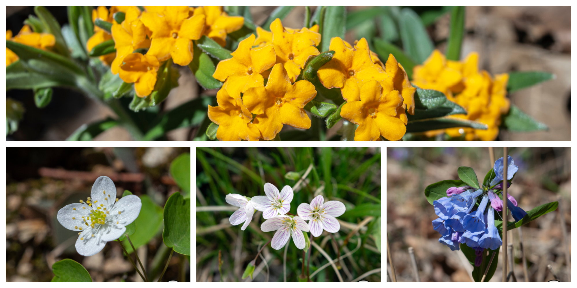
The rivers’ confluence is no longer visible from the overlook, as the Missouri and Osage are constantly in motion. In addition, engineering has altered the Missouri’s course. However, Clark’s Hill appears much as it did when he climbed it more than 200 years ago. It remains a forested, rugged ridge. It’s also home to the rare amethyst shooting star wildflower.
Length 1-mile out and back.
Address and location
The address is 1816 Osage Hickory St, Jefferson City, MO 65101. The trail is immediately north of rural Osage City, Mo.Distance The historic site is about two hours and 45 minutes from Downtown Kansas City. There are numerous hikes nearby.
Conditions This is a natural surface trail with moderate elevation changes. The best time to visit is from late fall-early spring. In summer, the trail may be overgrown and heavy with poison ivy.
Kid friendly? Children will need to be able to walk the trail. There are some steep drop-offs on the north side.
How busy? You’ll probably have it to yourself. This is a remote trail.
Pets Yes, on a leash.
Trails near Clark’s Hill and Norton State Historic Site


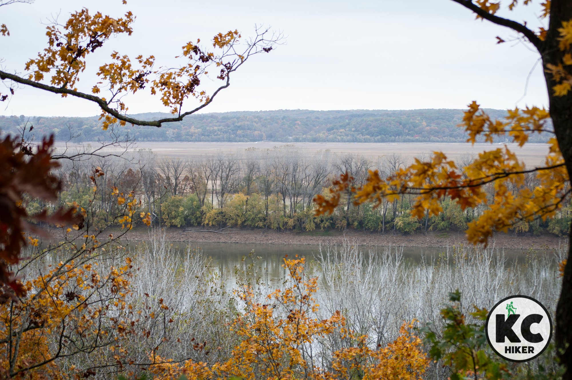

Hike the Osage Cliffs at Painted Rock Conservation Area
The Scenic Trail at Painted Rock Conservation Area offers spectacular views of the Osage River valley and surrounding area. The two-mile loop begins in an oak and hickory forest before reaching an overlook and descending into a rocky hillside. Rugged cliffs frequently jut outward toward the river. It’s a classic example of central Missouri topography, with rolling hills and forest interrupted by rocky ravines and outcroppings. This 1,480-acre refuge is in a remote area about 30 minutes southeast of Jefferson City.
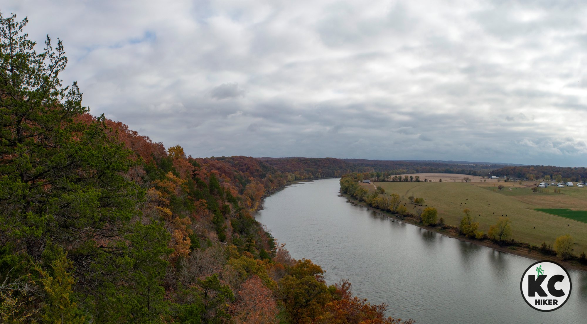
This remote area is home to oak-hickory forest, rock outcroppings and scenic views of the Osage River.
Trail Scenic Trail at Painted Rock Conservation Area
Overview
The Scenic Trail at Painted Rock Conservation Area offers spectacular views of the Osage River valley and surrounding area. The two-mile loop begins in an oak and hickory forest before reaching an overlook and descending into a rocky hillside. Rugged cliffs frequently jut outward toward the river. It’s a classic example of central Missouri topography, with rolling hills and forest interrupted by rocky ravines and outcroppings. This 1,480-acre refuge is in a remote area about 30 minutes southeast of Jefferson City. Since this is a Missouri Conservation Area, follow posted safety instructions during hunting seasons.
Length 2-mile loop.
Address and location The trailhead is on the west side of Highway 133. A gravel Conservation Department road leads about one-quarter of a mile to a parking lot, where the trail entrance is clearly posted.
Distance The refuge is about two hours and 45 minutes from Downtown Kansas City. There are also several other recommended trails in the vicinity.
Conditions This is a natural surface trail that is well maintained. The section following the first scenic overlook becomes rocky, with elevation changes. It is not a challenging walk, but could be difficult for someone with mobility issues.
Kid friendly? Children will need to be able to walk the trail. There’s plenty of beauty for curious kids to explore.
How busy? This park experiences low-moderate traffic.
Pets Yes, on a leash.


Lawrence Arboretum: Explore a serene urban garden
The Lawrence Rotary Arboretum features about 100 species of trees in a serene 30-acre environment on the city’s southwest side. The area can be explored on 1.1 miles of trails that are both paved, gravel and mowed. Two lakes and a stream are the centerpiece of the area, which also features a pergola, garden and gazebo. The garden areas feature pollinator plants and butterfly habitat. There are also sections of restored prairie, making it an excellent place for birdwatching. For most, this park is not a destination in and of itself, but is an excellent compliment to other Lawrence area trails.

This vibrant park is an excellent compliment to other Lawrence hikes.
Trail Lawrence Rotary Arboretum
Overview
The Lawrence Rotary Arboretum features about 100 species of trees in a serene 30-acre environment on the city’s southwest side. The area can be explored on looping trails that are paved, gravel and mowed. Two lakes and a stream are the centerpiece of the area, which also features a pergola, garden and gazebo. The garden areas feature pollinator plants and butterfly habitat. There are also sections of restored prairie, making it an excellent place for birdwatching. For most, this park is not a destination in and of itself, but is an excellent compliment to other Lawrence area trails.
Length Several loops result in about 1 mile of walking. To walk further, retrace the loops.
Address and location Lawrence Rotary Arboretum, 5100 W 27th St, Lawrence, KS 66047.
Distance The park is about 45 minutes from Downtown Kansas City.
Conditions This is a level trail with sections that are paved, gravel and mowed. It’s well-maintained and easy to follow.
Kid friendly? This is an easy walk, with most of it stroller-friendly. Parents will need to supervise small children near the two ponds. Restrooms are available.
How busy? This park is in an urban area and may experience moderate traffic on pleasant days.
Pets Yes, on a leash.


At Shawnee Bend, a path through thick forest leads to rocky bluffs
While Truman Lake State Park offers excellent trails, there are also dynamic trails outside the park. One of the standouts is the Shawnee Bend Bluff Trail, located on Corps of Engineers land in Shawnee Bend Recreation Area. This trail leads to arguably the best blufftop views on the lake. After walking through forest and meadows, the trail parallels the lakefront bluffs, giving access to the jutting cliffs. In addition to those environments, you’ll find remnants of bygone eras when people tried to scratch out a living in the rocky soil.

The woods and cliffs offer solitude and views of wildlife.
Trail Shawnee Bend Bluff Trail at Truman Lake, Shawnee Bend Recreation Area.
Overview
While Truman Lake State Park offers excellent trails, there are also dynamic trails outside the park. One of the standouts is the Shawnee Bend Bluff Trail, located on Corps of Engineers land in Shawnee Bend Recreation Area. This trail leads to arguably the best blufftop views on the lake. After walking through forest and meadows, the trail parallels the lakefront bluffs, giving access to the jutting cliffs. In addition to those environments, you’ll find remnants of bygone eras when people tried to scratch out a living in the rocky soil.
Length There is one main loop, with several connectors. The main loop is 2.3 miles long, but the connectors can add more mileage.
Address and location The trailhead is on the west side of the boat access parking lot: Shawnee Bend Boat Access Rd, Warsaw, MO 65355.
Distance The park is about one hour and 45 minutes from Downtown Kansas City.
Conditions This is a natural surface trail and the main loop is easy to follow. The connecting trails may not be as clear. Insect repellant is recommended.
Kid friendly? This is an easy trail to walk, with minimal elevation changes. The overlook cliffs are steep and carelessness could result in injury.
How busy? This park is a popular destination, although this woodsy trail does not attract near as much attention. It experiences minimal traffic.
Pets Yes, on a leash.


Dunn Ranch and Pawnee Prairie are restoring native grasslands
Much of northern Missouri was originally covered in rolling, tallgrass prairie. Bison roamed freely along with birds, mammals and even aquatic life in streams. For better or worse, agriculture subdivided, separated and plowed most of the area, turning it into productive farmland. This practice reduces species’ habitat and puts roadblocks into their migratory paths. The private Nature Conservancy manages about 2,000 acres of prairie, some of which has never been disturbed. The area is stocked with bison, which can be observed from several roadside viewing stations. Although access to the area is limited to a small nature trail, this area includes a picnic shelter, restrooms an observation deck and even an electric car charging station. If you want to get out into the prairie, just travel 10 minutes west to the state-managed Pawnee Prairie Natural Area. Hikers have unlimited access and there is a rough, natural trail that assists in exploration.

Tallgrass prairie once dominated the Iowa-Missouri border area. Thanks to state and private efforts, thousands of acres are being restored.
Trails Pawnee Prairie Natural Area and Dunn Ranch Prairie
Overview
Much of northern Missouri was originally covered in rolling, tallgrass prairie. Bison roamed freely along with birds, mammals and even aquatic life in streams. For better or worse, agriculture subdivided, separated and plowed most of the area, turning it into productive farmland. This practice reduces species’ habitat and puts roadblocks in their migratory paths. The private Nature Conservancy manages about 2,000 acres of prairie, some of which has never been disturbed. The area is stocked with bison, which can be observed from several roadside viewing stations. Access to the area is limited to a small nature trail. However, the trailhead includes a picnic shelter, restrooms an observation deck and even an electric car charging station. If you want to get out into the prairie, just travel 10 minutes west to the state-managed Pawnee Prairie Natural Area. Hikers have unlimited access and there is a rough, natural trail that assists in exploration. Prairies offer little cover, so be mindful of sun and heat. In addition, the Pawnee trail will lead through some knee-high grasses, so ticks can be an issue during the warmer months. Choose an appropriate day and season to visit these northern Missouri prairies and you’ll be lost in solitude and limitless horizons. In addition, wildlife, especially birds, are ubiquitous.
Length There are about two miles of trails at Pawnee Prairie (one mile out and one mile back) and a short nature trail at Dunn Ranch.
Address and location
The Dunn Ranch office, nature trail, shelter and restrooms are at 16970 W 150th St, Hatfield, MO 64458. See the map below to locate bison viewing areas.
Pawnee Prairie is just outside the village of Hatfield, about 10 minutes east of Dunn Ranch. Take Highway 46 to 140th Street, then head south. GPS directions will lead you to someone’s backyard.
Distance Dunn Ranch and Pawnee Prairie are just under two hours from Downtown Kansas City.
Conditions Dunn Ranch has a short, all-access, paved nature trail and an observation deck. Pawnee Prairie’s trail is a dirt farm road with knee-high grasses; insect repellent is necessary in warmer months. There is no shade cover on either trail so plan accordingly.
Kid friendly? Dunn Ranch’s short trail is accessible to all. Pawnee Prairie will require children to walk or be carried; thick vegetation could result in bug bites and ticks.
How busy? These remote areas receive few visitors except when specially organized events occur.
Pets Yes, on a leash.
Bikes Prohibited
Regional attractions


Directions: Dunn Ranch Prairie
This address will take you to the office, nature trail and picnic area.
Directions: Pawnee Prairie Natural Area
GPS will take you to this address in someone’s backyard in Hatfield, Mo. Take Highway 46 to 140th Avenue and travel about one mile south, where you will see the trailhead.

It’s nature in the raw at Flint Hills Tallgrass Prairie Preserve
More than 2,000 acres of the Flint Hills, east of the small town of Cassoday, are open to the public, courtesy of The Nature Conservancy. A central feature of this property is the crystalline South Fork of the Cottonwood River. It traverses the low point of the property, shrouded in tall Cottonwood trees. This is a prime place for viewing wildflowers and wildlife.

The Nature Conservancy opened this refuge, near Cassoday, Kansas, to the public in 2023.
Trail Flint Hills Tallgrass Prairie Preserve
Overview
It would be easy to confuse this nature preserve with the similar sounding Tallgrass Prairie National Preserve near Strong City, Kan. While that preserve is run by the National Park Service, this location is entirely in private hands. More than 2,000 acres, east of the small town of Cassoday, are open to the public, courtesy of The Nature Conservancy. If you’re looking for even more solitude than the Flint Hills normally provide, this is for you. It’s a less-trafficked area than Konza Prairie or the national park. A central feature of this property is the crystalline South Fork of the Cottonwood River. It traverses the low point of the property, shrouded in tall Cottonwood trees. This is a prime place for viewing wildflowers and wildlife. Be mindful of sun and temperature as there is little shade or protection from wind on most of the trails.
The difference between this area of the Flint Hills and the other two parks cited above? These hills are more low lying. Although scenic and rolling, you won’t encounter as many steep grades and plunging ravines as elsewhere in the Flint Hills. That also makes for a more moderate physical challenge, giving you plenty of opportunities to catch your breath.
Length There are about six miles of trails throughout the refuge.
Address and location 16999 NE 150th St, Cassoday, KS 66842.
Distance A takes a little more than two hours to reach this park from Downtown Kansas City. The last few miles take you on a gravel road. There is a small parking area that is well marked.
Conditions Understand that this is not a national or state park. It is a private nature preserve open to the public. Trails are natural surface, which means they can be muddy. These are mowed paths, which means the grass may be higher than you would anticipate. Grass will likely be rubbing your calves or pant legs, so insect repellent is appropriate. While trails are easy to see and follow in the upland areas, they seem to disappear in lowland river crossings. If you are keen on hiking all the trails, you will likely have at least one moment when you aren’t sure where to go next. In wet seasons, your feet will get wet crossing the South Fork Cottonwood River (crossings are not deep, but soggy toes are inevitable).
Kid friendly? Trails are natural surface and not conducive to strollers. However, trails are no more than moderate in difficulty and should be suitable for children who like to walk. The streams are beautiful and a great place for kids to play.
How busy? This park is remote and lightly trafficked – but don’t be surprised to see others there, especially on a beautiful day.
Pets Yes, on a leash.
Bikes Prohibited
Nearby attractions


Wild, wet prairies and woods thrive at Pershing State Park
Northern Missouri is not well known to outdoor enthusiasts, but that only means it’s a well-kept secret. Rolling hills, forests and pristine prairies are worthy of exploration. Pershing State Park, near Laclede, Mo., is a scenic example of the prairie environment. Locust Creek flows in the midst of marshes, wetlands and riparian forest. The more than 5,000-acre park is home to 9 miles of trails, including a unique 1.6-mile boardwalk through a delicate wetland environment. Birds, reptiles and water-oriented mammals can be observed. Pershing State Park is home to the largest remaining wetland prairie in Missouri, measuring at about 1,000 acres. This generally flat and low-lying area makes for easy, but wild and scenic, hiking.

Explore more than 5,000 acres on 9 miles of trails in this unique biological environment.
Trail Pershing State Park
Overview
Northern Missouri is not well known to outdoor enthusiasts, but that only means it’s a well-kept secret. Rolling hills, forests and pristine prairies are worthy of exploration. Pershing State Park, near Laclede, Mo., is a scenic example of the prairie environment. Locust Creek flows in the midst of marshes, wetlands and riparian forest. The more than 5,000-acre park is home to 9 miles of trails, including a unique 1.6-mile boardwalk through a delicate wetland environment. Birds, reptiles and water-oriented mammals can be observed. Pershing State Park is home to the largest remaining wetland prairie in Missouri, measuring at about 1,000 acres. This generally flat and low-lying area makes for easy, but wild and scenic, hiking.
Length There are 9 miles of trails throughout the park.
Address and location Pershing State Park, 29277 Missouri 130, Laclede, MO 64651.
Distance The park is less than two hours from Downtown Kansas City, near Laclede, Mo.
Conditions The parks’ trails are natural surface and are generally well-marked and maintained. The boardwalk trail has a wooden surface, while all others are natural surface. The park’s longest hike, the 6-mile one-way Riparian Trail, is sometimes overgrown as you walk south. In summer, this could be problematic because of weeds, insects and ticks. Completing the full Riparian Trail is best in late fall, winter or early spring.
Camping Primitive camping is allowed on the Riparian Trail. The group must be less than seven people and camp 100 feet away from the trail, at least one-fourth mile from the trailhead or access point and 200 feet away from a lake or stream. The Riparian Trail is six miles long through Pershing State Park, but it continues into Fountain Grove Conservation Area. The conservation area only allows primitive camping at designated sites, none of which border the park.
Kid friendly? Trails are natural surface and not conducive to strollers. However, trails are moderate in difficulty and should be suitable for children who like to walk.
How busy? This park will be busier than usual during peak weather and on holidays. However, it’s generally moderately trafficked.
Pets Yes, on a leash.


Explore the rolling green hills of northern Missouri at Crowder State Park
Northern Missouri is usually not at the top of hikers’ destination lists. But it should be. This remote, rural area holds surprising beauty and few crowds (Shhhh! Don’t tell anyone!). Whie this area is often synonymous with farmland, its native state was a mix of forest and prairie. At Crowder State Park, this forest of maple, pines, oaks (and more) is preserved. Rolling hills, ravines and sandstone outcroppings make for a unique hiking environment. Hikers will also encounter Crowder Lake, the Thompson River, wildflowers and wildlife traditionally associated with central and northern Missouri.

Nearly 2,000 acres provide 17 miles of trails through forested hills and over streams.
Trail Crowder State Park
Overview
Northern Missouri is usually not at the top of hikers’ destination lists. But it should be. This remote, rural area holds surprising beauty and few crowds (Shhhh! Don’t tell anyone!). While this area is often synonymous with farmland, its native state was a mix of forest and prairie. At Crowder State Park, this forest of maple, pines, oaks (and more) is preserved. Rolling hills, ravines and sandstone outcroppings make for a unique hiking environment. Hikers will also encounter Crowder Lake, the Thompson River, wildflowers and wildlife traditionally associated with central and northern Missouri.
Length There are 17 miles of trails throughout the park.
Address and location Crowder State Park, 8598, 76 MO-128, Trenton, MO 64683
Distance The park is less than two hours from Downtown Kansas City, near Trenton, Mo.
Conditions The parks’ trails are natural surface and are well-marked and maintained. They include moderate elevation gains. Footing will be slippery after a rain or thaw.
Kid friendly? Trails are natural surface and not conducive to strollers. However, trails are moderate in difficulty and should be suitable for children who like to walk.
How busy? This park will be busier than usual during peak weather and on holidays. However, it’s generally moderately trafficked.
Pets Yes, on a leash.


Small town Missouri hiking at its best: Warsaw Riverfront Trails
The picturesque riverfront town of Warsaw, Mo., offers more than six miles of trails along the Osage River. These unique trails explore Drake Harbor, near the city’s downtown area, and also cross the river via the Joe Dice Swinging Bridge, a structure built in 1928. In addition, miles of trails follow the waterfront and are prime areas to view waterfowl and birds of prey.

The Joe Dice Swinging Bridge, built in 1928, is an integral part of Warsaw’s small town trail network. The 600-foot walkway has been exclusively for pedestrians since 1979.
Set on a picturesque arm of Truman Lake, the city of Warsaw, Missouri, offers 6 miles of nature-friendly hiking and biking trails.
Trail Warsaw, Mo., Riverfront Trails
Overview
Warsaw, Mo., sits on the Osage River between Truman Lake and Lake of the Ozarks. While those two recreation destinations get most of the attention, this small town offers more than 6 miles of paved and gravel trails along the river. They provide an excellent vantage point to view waterfowl, birds of prey and other animals that habitat the riverfront area. Trails also border downtown Warsaw and Drake Harbor, which is a park and boating area. A prominent attraction is the 600-foot-long Joe Dice Bridge. Originally built in 1928, it supported vehicle traffic until 1979 and has been exclusively a pedestrian bridge since then. It connects trails on both sides of the water. Downtown Warsaw is one block from the trail and offers restaurants and a few gift shops. It’s also home to some historic structures.
Length There are about six miles of trails on the Warsaw Riverfront.
Address and location The Joe Dice Swinging Bridge trailhead is at 801 Kennedy Drive, Warsaw, MO 65355. However, the trail can be accessed at several other points. Download the trail map for more information.
Distance Warsaw, Mo., is less than two hours from Downtown Kansas City, Mo.
Conditions The Warsaw Riverfront Trails are a combination of paved and gravel. They are well marked and are generally level with few elevation changes. There is very little shade, so your visit will be more enjoyable on a day that’s overcast or with mild temperatures.
Kid friendly? The trail on the Warsaw side of the river (the Drake Harbor Trail) is paved and leads past a large park with a playground. The gravel trails will be difficult for pushing strollers. All trails border the waterfront, so parents will need to be mindful of water safety for small children.
How busy? This is a moderately trafficked trail.
Pets Yes, on a leash.
Other area hikes
Harry S Truman State Park, on Truman Lake, is home to three scenic natural surface hiking trails. It’s about 15 minutes from Warsaw.


Rocky bluffs, eagles and vistas abound at Truman Lake State Park
Harry S Truman State Park offers some of the most scenic trails in central Missouri. A rocky, forested peninsula rises about 150 feet above the lake, creating a rugged and scenic playground for hikers. They can explore the terrain on three well marked and maintained trails.

Truman Lake State Park offers three trails that explore the rocky bluffs, forests and glades of a 1,400-acre peninsula that rises sharply from the water.
This central Missouri location resembles the rugged landscape of the Ozarks.
Trail Trails at Truman Lake State Park
Overview
Missouri’s Truman Lake doesn’t usually generate excitement among hikers. That’s for fishing buffs, right? Yet there is spectacular hiking to be found. Part of the confusion is that the lake is massive, with 55,000 acres stretched across parts of four counties. That means topography varies. For example, the well-traveled section of Highway 13 that runs south of Clinton crosses the lake in a fairly flat area. Meh. However, a few miles east, Harry S Truman State Park offers some of the most scenic trails in central Missouri. A rocky, forested peninsula rises about 150 feet above the lake, creating a rugged and scenic playground for hikers. Trails afford distant views across the reservoir and region. The park is also an excellent place to view wildlife, including eagles and birds of prey soaring above the water. Wildflowers and woods stretch across the peninsula from shore to shore.
Length There are about four miles of trails throughout the park. These are:
Bluff Ridge Trail, 1.8 miles
1,000th Mile Trail, 0.9 miles
Western Wallflower Trail, 0.8 miles
Address and location Harry S Truman State Park, 28761 State Park Road West, Warsaw, MO 65355
Distance The park is less than two hours from Downtown Kansas City, near Warsaw, Mo.
Conditions There are three natural surface trails that are well marked and maintained. There is moderate elevation gain on each.
Kid friendly? Trails are natural surface and not conducive to strollers. There are also some steep drop-offs, so parental supervision is required.
How busy? This park is a popular camping destination, so it can be highly populated in summer and on holidays. Visit in the off season or on a weekday for a quieter experience.
Pets Yes, on a leash.

View from a blufftop on the 1000th Mile Trail at Harry S Truman State Park.

Cliffs rise sharply from the lake on the Bluff Ridge Trail at Harry S Truman State Park.

The Western Wallflower Trail at Harry S Truman State Park explores savannah and glade environments overlooking the lake.

Harry S Truman State Park is a prime location to view wildflowers and wildlife.

Graham Cave State Park: Waterfalls, rocky hills and a mysterious cavern
Missouri’s Graham Cave State Park is one of those just-off-the-interstate phenomena that most motorists are oblivious of. And that’s not a bad thing, because it means we can keep the park to ourselves. The park’s namesake cave is impressive with an entrance more than 100 feet wide. The cave can no longer be entered, but visitors can peer inside along the full length of the rock shelf that forms it. Archeology has determined that hunters and gatherers have used it for up to 10,000 years. Finds have included pottery, arrowheads and spears. The cave apparently provided temporary shelter for natives over thousands of years. Beyond the cave, which only takes a few minutes to see, the 386-acre park is a wealth of trails. Rocky hills, clear streams and waterfalls are found throughout its 4.6 miles of trails. A noted feature is the Graham Cave Glades Natural Area, an 82-acre zone comprised of of sandstone and dolomite glades.

Graham Cave has provided shelter for humans for up to 10,000 years and has yielded arrowheads, pottery and other artifacts.
An impressively wide cave entrance has been home to humans for up to 10,000 years.
Trail Trails at Graham Cave State Park
Overview
Missouri’s Graham Cave State Park is one of those just-off-the-interstate phenomena that most motorists are oblivious of. And that’s not a bad thing, – we can keep the park’s serenity to ourselves. Graham’s namesake cave is impressive, with an entrance 120 feet wide. At one point, the cave extended 100 feet into the hill, with up to 16 feet of height. Debris infill has slowly reduced its size. Although the cave can no longer be entered, visitors can peer inside along the full length of the rock shelf that forms it. Archeology has determined that hunters and gatherers have used it for up to 10,000 years, but apparently never made it a permanent home. Finds have included pottery, arrowheads and spears. Beyond the cave, which only takes a few minutes to see, the 386-acre park is a wealth of trails. Rocky hills, clear streams and waterfalls are found throughout its 4.6 miles of trails. The area’s foundation is dolomite limestone and sandstone – prime material for erosion to create caves, cliffs and crystalline streams. A noted feature is the Graham Cave Glades Natural Area, an 82-acre zone comprised of of sandstone and dolomite glades. While most trails crisscross rocky and rolling terrain, the Loutre River Trail is a quiet path through bottomland forest next to the stream.
Length There are 4.6 miles of trails throughout the park.
Address and location Graham Cave State Park, 217 State Hwy TT, Danville, Mo. 63361.
Distance The park is about two and a-half hours from Downtown Kansas City. It is east of Columbia, Mo., right off I-70. Graham Cave is near Columbia, Mo., so can be visited on the same trip as other area hiking destinations. It’s also a great pit stop if you’re headed from Kansas City to St. Louis on I-70.
Conditions Most of Graham Cave State Park’s trails are natural surface, but there are a few paved sections. There are a few relatively steep elevation grades, but the trails are of no more than moderate difficulty.
Kid friendly? The paved trails are stroller friendly. Otherwise, kids will need to walk. Children will enjoy rocks and streams and there is also a playground at the park.
How busy? This park is moderately busy, particularly on holidays and in optimal weather.
Pets Yes, on a leash.
Other hiking opportunities near Graham Cave State Park


Perry Lake Trail: Explore rugged, forested terrain in eastern Kansas
The Perry Lake Trail is a 29-mile hiking loop trail, mostly on U.S. Corps of Engineers land. It leads hikers through Ozark-type topography along the lakeshore and through steep and rugged hills in eastern Kansas. The trail generally follows the shoreline and bluffs along a peninsula on Perry Lake’s eastern side.

The Perry Lake Trail, near Ozawkie, Kansas, covers rolling, steep and rugged terrain along the shore of the reservoir.
A loop trail, mostly on U.S. Corps of Engineers land, leads hikers through Ozark-type topography along the lakeshore.
Trail Perry Lake Trail (also referred to as The Old Military Trail)
Overview
Ready to get remote? Perry Lake is an 11,500-acre reservoir about 25 miles northeast of Lawrence, Kansas. The Perry Lake Trail (also called The Old Military Trail) is a 29-mile loop following the shoreline of a peninsula on the lake’s eastern side. After a few minutes on the trail, sounds of civilization recede and you realize you’re “all in” with nature. This trail explores what is sometimes called Kansas’ “Little Ozarks,” a hilly area that was previously a valley of the Delaware River. The area is surprisingly scenic, from the rocky lakeshore to steep, forested bluffs. According to AllTrails, total elevation gain on the full 29-miles is more than 2,000 feet. The northern end of the trail, accessed by the Old Military Trailhead, is known for its steep inclines. This remote area lends itself to wildlife, so have your camera, phone or binoculars ready. Very few people will hike the entire loop, so you can pick a section and hike and out-and-back. Primitive camping is not allowed on the trail, but hikers can camp at established campsites that intersect the trail. The Perry Lake Trail (Old Military Trail) is different from the more well-known mountain bike trails on the western side of the lake.
Length 29-mile loop. To shorten the hike, create your own out-and-back or exit the trail at an intersecting campsite or crossroads.
Address and location We recommend beginning your hike at the Old Military Trailhead on Ferguson Road (see trailhead map below). There is ample parking. At this trailhead, you’ll find a gated, asphalt road in disrepair (this is not the trail). The natural surface trail is marked with a sign; enter here to walk toward the lakeshore.

Distance This trailhead is about 1 hour from Downtown Kansas City.
Conditions This single-track dirt trail is steep and rugged. The northern section is well marked and maintained. Beyond this, we cannot vouch for the condition of the full 29 miles. Because of the density of the forest, fall, winter and spring are the best seasons to minimize ticks, bugs and poison ivy.
Kid friendly? Kids will need to be up for a strenuous hike.
How busy? This is a remote trail, so you’ll likely encounter few people. The lake is a popular boating destination, so you may see and hear boat traffic on the reservoir.
Pets Yes, on a leash.
Bikes Prohibited (however there are numerous mountain bike trails on the west side of the lake).


Trailhead: Old Military Trail, Perry Lake

Rocks of ages on display at Ha Ha Tonka State Park
Ha Ha Tonka State Park is a premiere Missouri hiking destination (or is it the premiere destination?). Conde Nast Traveler called it the most beautiful spot in Missouri. What’s the hubbub about? To sum it up, Ha Ha Tonka is built around the erosion of “Rocks of Ages.” Water has worn down bedrock, resulting in collapsed caves, still-existing caves, sinkholes and a natural bridge. Ha Ha Tonka spring gushes 48 million gallons of water into the Lake of the Ozarks daily. Other highlights include 250-bluffs overlooking the lake, a natural island surrounded by rushing spring water and “The Devil’s Kitchen,” a massive overhang on the quieter side of the park.

The spring a Missouri’s Ha Ha Tonka State Park emits 48 million gallons per day into the Lake of the Ozarks.
USA Today readers named it the fourth best state park in America.
Trail Ha Ha Tonka State Park
Overview
Ha Ha Tonka State Park is a premiere Missouri hiking destination (or is it the premiere destination?). Conde Nast Traveler called it the most beautiful spot in Missouri. What’s the hubbub about? To sum it up, Ha Ha Tonka is built around the erosion of “Rocks of Ages.” Water has worn down bedrock, resulting in collapsed caves, still-existing caves, sinkholes and a natural bridge. Ha Ha Tonka spring gushes 48 million gallons of water into the Lake of the Ozarks daily. Other highlights include 250-bluffs overlooking the lake, a natural island surrounded by rushing spring water and “The Devil’s Kitchen,” a massive overhang on the quieter side of the park. Although most people stick to the castle, cliffs and spring area, there is much more to the park. About 3,000 acres of oak woodland can be explored, featuring some trees that are more than 300 years old. The Missouri Department of Conservation calls it “one of the best open oak woodland landscapes in Missouri that has been restored and managed.” This area can best be explored via the 6.5-mile Turkey Pen Hollow Trail, which also provides access to three primitive camping sites.
A castle in Missouri?
Oh, and did we mention the castle? Yeah, there’s a castle at the top of a cliff with an incredible vista of the lake. The castle story, however, is more tragedy than fairy tale – yet its story likely resulted in the area being preserved for us today. The castle’s founder and visionary, Robert M. Snyder, died before it was completed. It was finished by his sons in 1922, but a chimney fire in the 1940s destroyed all but the stone walls. The stunning nature of the castle and the completion of Lake of the Ozarks in 1931 put Ha Ha Tonka on the map. Yet this stunning area remained abandoned until 1978, when it was opened as a state park. Snyder’s notes about the area still beckon visitors today: "Here I will spend my leisure, secure from the worries of business and the excitement of city life. I will fish and loaf and explore the caves of these hills, with no fear of intrusion." And so should you.
And what about the odd name? Ha Ha Tonka is generally attributed to an Osage tribe description that meant laughing waters, in reference to the spring.
Length There are more than 10 miles of trails on which to explore this park. (The state park website says there are 31 miles of trails, however, this is overstated because it includes “water trails” which are for canoe and kayak use.)
Address and location Ha Ha Tonka State Park, 1491 State Road D, Camdenton, MO 65020; although many people park at the castle ruins, there are several smaller lots throughout the park.
Distance This park is about 2 hours and 45 minutes from Downtown Kansas City.
Conditions There are several wheelchair accessible areas, but overall this park is rugged with steep elevation gains. The impact of the grade is lessened in some areas by stairs and bannisters. Wear sturdy shoes and beware of wet areas and loose rock. Trekking polls are recommended.
Kid friendly? Kids will need to be up for a strenuous hike.
How busy? This is one of the state’s most popular parks in one of the state’s most popular tourist areas (Lake of the Ozarks). If you want a quieter experience, go in the off season or from Monday-Thursday.
Pets Yes, on a leash.
Bikes Restricted.


At Elk City, waves of grain give way to fields boulders
Elk City State Park sprawls over more than 5,000 acres in south central Kansas. At its heart is the Elk City Reservoir. While there is much here for water enthusiasts and anglers, the park is a premiere attraction for hikers and mountain bikers. It includes more than 15-miles of trails, ranging from entry-level nature walks to routes that lead through boulder-scrambling heights.

The Table Mound Trail at Elk City State Park, Independence, Kansas
The Chautauqua Hills break through the plains in spectacular cliffs, canyons and rugged hills.
Trail Elk City State Park
Overview
Elk City State Park sprawls over more than 5,000 acres in south central Kansas. At its heart is the Elk City Reservoir. While there is much here for water enthusiasts and anglers, the park is a premiere attraction for hikers and mountain bikers. It includes more than 15-miles of trails, ranging from entry-level nature walks to routes that lead through boulder-scrambling heights. Table Mound, which rises about 250 feet above the surrounding farmland, is the centerpiece. Trails in this area cut through the Chautauqua Hills, uplifted rock made of layers sandstone, shale and limestone. Erosion and gravity has fractured Table Mound, resulted in surrounding fields of boulders. It makes for challenging but spectacular hiking. Unlike much of Kansas, this area is also heavily forested (except where it has been cleared for agriculture), with cedar trees predominating.
Note: The 15-mile Elk River Trail is nearby, but is not in Elk City State Park. Learn more about that trail here.
Length There are more than 15 miles of trails at Elk City State Park. Highlights include:
Table Mound Trail 5 miles out-and-back. If you don’t want to hike 5 miles, you can begin at the overlook parking lot and chart a shorter course (hikers only).
Post Oak Nature Trail One-mile loop atop Table Mound (hikers only).
Green Thumb Nature Trail One mile-loop beginning at Timber Road Campground (hikers only).
Eagle Rock Mountain Bike Trail Four miles, multiple loops.
Distance Elk City State Park is a little under three hours from downtown Kansas City.
Conditions Except for the nature trails, hiking at Elk City State Park is challenging and strenuous. Trails are well-marked and maintain, but they are natural surface and subject to snow and rain. In addition, there are significant elevation changes and rocky footing.
Kid friendly? Kids will need to be up for a strenuous hike.
How busy? On holidays and during warm weather, this park can be popular. If you want a less-trafficked experience, visit on a weekday or in the offseason.
Pets Yes, on a leash.
Bikes Only on the mountain bike trail.
Address and location Elk City State Park, 4825 Squaw Creek Rd, Independence, KS 67301


Moon Loop is a journey through a once-lost forest
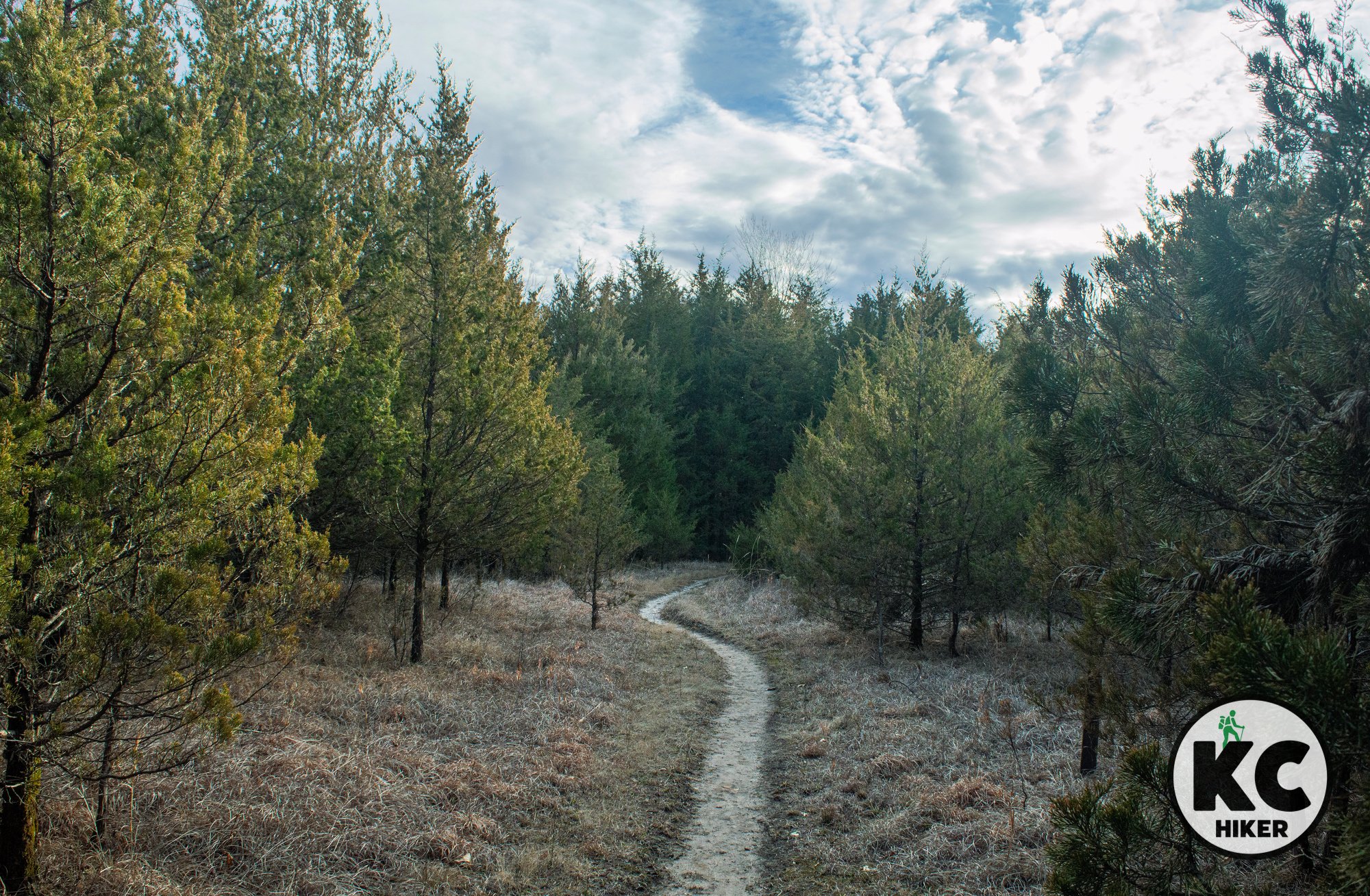
Moon Loop is a trail in the small segment of Mark Twain National Forest that is north of the Missouri River near Columbia, Mo. This pleasant six-miler is a mostly level walk through dense, dark forest comprised mostly of cedar, oak and hickory. It crosses Big Branch Creek – a crystalline rocky stream – two times. There are also occasional gaps of prairie. Moon Loop is a restoration success story. Before the Great Depression, the area was intensely farmed and quarried. This depleted the soil and caused many residents to leave in the 1930s. Some remnants of their farming efforts remain. The name “Moon Loop” refers to the appearance of the area before reclamation efforts were underway. This quiet, wooded trail is testament to reforestation efforts.
Moon Loop Trail in the Cedar Creek Ranger District of Mark Twain National Forest
A six-mile loop near Columbia follows a narrow trail through thick woods.
Trail Moon Loop, Cedar Creek Ranger District, Mark Twain National Forest
Overview
Moon Loop is a trail in the small segment of Mark Twain National Forest that is north of the Missouri River near Columbia, Mo. This pleasant six-miler is a mostly level walk through dense, dark forest comprised mostly of cedar, oak and hickory. It crosses Big Branch Creek – a crystalline rocky stream – two times. There are also occasional gaps of prairie. Moon Loop is a restoration success story. Before the Great Depression, the area was intensely farmed and quarried. This depleted the soil and caused many residents to leave in the 1930s. Some remnants of their farming efforts remain. The name “Moon Loop” refers to the appearance of the area before reclamation efforts were underway. This quiet, wooded trail is testament to reforestation efforts.Other hiking opportunities near Columbia, Mo.
Length
The loop is about six miles long.
Address and location
There are five trailheads for Moon Loop. All are rural and you can view them on the trail map below. The only one with an actual street address is an east trailhead at 8582-9201 S. Ginn Lane, Columbia, MO 65201. Parking is limited and will be on grass or gravel. Most access roads are gravel.
Conditions Moon Loop is a natural surface trail that is in excellent condition. Topography is mostly level but there are some moderate hills and a few creek crossings.
Kid friendly? Kids will have to be hearty hikers to enjoy this trail. Highlights for them will be the opportunities to play in Big Branch Creek.
How busy? This trail is near Columbia, Mo., and is moderately trafficked.
Pets Yes, on a leash (unless otherwise designated).
Bikes Yes unless otherwise designated.